Himalayan Range of Nepal

This is a photograph of Himalayan Range of Nepal.

Hatiya Bazaar from Ghumte Hill

Hatiya Bazaar from Ghumte.

Hatiya Bazaar From Charaudi

Hatiya Bazaar From Charaudi

Suspension Bridge of Hatiya

Suspension Bridge of Hatiya

Beautiful picture of Himalayan village

Beautiful picture of Himalayan village

Tuesday, February 28, 2012

Tourist Place of Galkot “Ghumte Hill”


Ghumte hill is the highest hill in the Baglung district. It’s also taken as honor of Galkot. From of the top of it we can see many place of the Nepal. It is a beautiful hill full of Nepalese National flower Rhododendron during the spring season. Every person who visits the Galkot they want to climb up the Ghumte and see the romantic sense. Every year on Baishak purnima as a festival of Buddha Purnima most people go there. On Ghumte lakh we can find many historical and religious instruments. On top of the Ghumte lakh,there is a famous temple named Siddha Baba. Near it there is famous cave name Bhairav cave. Every year people go inside this cave and try to search about the cave.  
In matter of Bharav Darbar or Bharav palace 24th state kings name also attached. In 1665 to 1670 Gorkha's king Ram shah also come Galkot. When he lived Galkot he was gone top of Ghumte. After worshiping the siddha Baba and Bharav he seeks and observes the beauty and romantic sense of Ghumte. At that time he found extraordinary cave. He like it much and wanted to live there. Than people called it palace because king Ram shah live there. It is also Called Ramcha Cave.

 Here another important and historical thing is that there is an extraordinary stick. In local language is called Bhimsen stick. It is remaining now as a statue. It carries a long history. Lack of reliable proof we are unable to explain about it. It is believed that Ghumte hill has traces of gold mine. Most part of the Ghumte is covered with forest. Inside the forest we can find different kinds of wild animals such as tiger, dear fox, and so on as well as we can find diffetent kinds of beautiful birds. Ghumte is very much for herbal medicine such as satuwa, panchoula, silagit etc.

Really Ghumte is a beautiful and romantic hill. The people who lives in Galkot and even who go away from the Galkot love the Ghumte very much.So people write the song include the Ghume and people who write poem they also put the Ghumte in their poem, One year ago Ghumte festival is orginazed by the Galkot inhabitants’ to share the news about the Galkot which help us to attracts the tourist. In future people made a plane that in Ghumte a cabul ropeway is going to build. After it will be very easy to go peck of the Ghumte and also it become a main tourist sector in this area.

Monday, February 27, 2012

History of Nepal


The recorded history of Nepal is centered on the Kathmandu valley and begins with the Kirantis who are said to have ruled for many centuries beginning from the 7th or 8th Century B.C. with their famous King Yalumber who is even mentioned in the epic, ‘Mahabharata’. The Gopalas who were herdsmen are believed to have ruled before the Kirantis but little is known about them. Their descendants are said to still live at the edge of the valley. Around 300 A.D. the Lichavis arrived from northern India and overthrew the Kirantis. The descendants of the Kirantis are the Rais and Limbus who predominate in eastern Nepal. One of the legacies of the Lichavis is the fabulous Changu Narayan Temple near Bhaktapur which dates back to the 5th Century. In early 7th Century, Amshuvarman, the first Thakuri king took over the throne from his father-in-law who was a Lichavi. He married off his daughter Bhrikuti to the famous Tibetan King Tsong Tsen Gampo thus establishing good relations with Tibet. Bhrikuti went on to convert the king to Buddhism. The Lichavis brought art and architecture to the valley but the golden age of creativity arrived with the Mallas who came to power around 1200 A.D.

During their 550 year rule, the Mallas built an amazing number of temples and splendid palaces with picturesque squares that are lined with architecturally beautiful temples. It was also during their rule that society and the cities became well organized, religious festivals were introduced and literature, music and art were encouraged. Sadly after the death of Yaksha Malla, the valley was divided into three kingdoms: Kathmandu (Kantipur), Bhaktapur (Bhadgaon) and Patan (Lalitpur). The rivalry among these kingdoms led to the building of grand palaces and the uplifting of the arts and culture. Around this time, the Nepal as we know it today was divided into about 46 independent principalities. One among these was the kingdom of Gorkha with a Shah king in power. Much of Kathmandu valley’s history around this time was recorded by Capuchin friars who lived here on their way in and out of Tibet.

Nepal, as a state, was established when an ambitious Gorkha king named Prithvi Narayan Shah embarked on a conquering mission that led to the defeat of all the kingdoms in the valley (including Kirtipur which was an independent state) by 1769. Instead of annexing the newly acquired states to his kingdom of Gorkha, Prithvi Narayan decided to move his capital to Kathmandu establishing the Shah dynasty which ruled unified Nepal from 1769 to 2008 when the last Shah ruler, Gyanendra relinquished his power to make way for total democracy under the rule of a Prime Minister.

The history of the Gorkha state goes back to 1559 when Dravya Shah established a kingdom in an area chiefly inhabited by Magars. At this time the Kathmandu valley was ruled by the Malla kings. During the 17th and early 18th centuries, Gorkha continued a slow expansion, conquering various states while forging alliances with others. Prithvi Narayan dedicated himself at an early age to the conquest of the Kathmandu valley. Recognizing the threat of the British Raj in India, he dismissed European missionaries from the country and for more than a century, Nepal remained in isolation.

During the mid-19th century Jung Bahadur Rana became Nepal's first prime minister to wield absolute power relegating the Shah king to a mere figurehead. He started a hereditary reign of the Ranas that lasted for 104 years during which time the Shah kings had no real power. The Ranas were overthrown in a democracy movement of the early 1950s with support from an unlikely person, the monarch of Nepal, King Tribhuvan. Soon after the overthrow of the Ranas, King Tribhuvan was reinstated as the head of the state. In early 1959, Tribhuvan's son King Mahendra issued a new constitution, and the first democratic elections for a national assembly were held. The Nepali Congress Party was victorious and their leader, Bisheshwar Prasad Koirala formed a government and served as prime minister. But by 1960, King Mahendra had changed his mind and dissolved Parliament, dismissing the first democratic government.

After many years of struggle when the political parties were banned, they finally mustered enough courage to start a people's movement in 1990. With the public rising up against absolute monarchy and demanding democracy, the then ruler King Birendra accepted constitutional reforms and established a multiparty parliament with himself as head of state and the prime minister heading the government. In May 1991, Nepal held its first parliamentary elections. In February 1996, one of the Communist parties (Maoist wing) went underground to wage a people's war against monarchy and the elected government.

Then on June 1, 2001, a horrific tragedy wiped out the entire royal family along with many of their close relatives. With only King Birendra’s brother, Gyanendra and his family surviving, he was crowned the king. King Gyanendra tolerated the elected government for only a short while and then dismissed Parliament to grab absolute power. In April 2006, strikes and street protests in Kathmandu led to a 19-day curfew and the political parties joined forces with the Maoist rebels to bring pressure on the monarch. Eventually, King Gyanendra realized it was futile holding on to power and relented. He agreed to reinstate parliament. But the political parties and a majority of the general public had had enough of dynastic rule and their abuse of power. On May 28, 2008, a newly elected Constituent Assembly declared Nepal a Federal Democratic Republic, abolishing the 240 year-old monarchy. Nepal today has a President as Head of State and a Prime Minister heading the Nepal Government.

Sunday, February 19, 2012

Dhorpatan Hunting Reserve

Dhorpatan Hunting Reserve lies in Rukum, Myagdi and Baglung Districts in the Dhaulagiri Himal range in West Nepal. Putha, Churen and Gurja Himal extend over the northern boundary of the reserve. Dhorpatan Hunting Reserve was established in 1983 and was gazetted in 1987. Management objectives of the reserve allow sports hunting and preserve a representative high altitude ecosystem in West Nepal
Details About the Reserve:

• The reserve extends over an area of 1325 sq. km and is the only hunting reserve in the country to meet the sports hunting needs of Nepalese and foreign hunters of blue sheep and other game animals. The higher elevations remain snow-capped throughout the year. Altitudes vary from 3000 m. to more than 7000 m. The flat meadows above tree line (4000 m), locally known as Patan, is divided into six blocks for hunting management purposes.

• The reserve is surrounded by villages on all sides except the north. Local people depend on the reserve to meet their requirements for wood, fuelwood, fodder, and pasture. The refugee camp near the reserve headquarters has put more human pressure in the forest. Every year livestock grazing activities begin from February and last until October. More than 80,000 livestock enter the reserve.

• The majority of people belong to the Mongoloid race, including Magar. Thakali, and Gurung, Amalgamation of different ethnic groups has resulted in a mixed pattern of cultures.

• Dhorbaraha, a Hindu religious place on the banks or Uttarganga River near Dhorpatan, is in Fagune bloc. Every year on the day of "Janai Purnima" in August, a religious fair is held here which is attended by many local devotees. The magnificent view of Dhaulagiri Himal from Barse. Dogari and Gustung blocs are exceptional. Snag and Sundaha bloc are rich in wild animals.
Vegetation and Wildlife:

• The reserve is characterized by alpine, sub-alpine and high temperate vegetation. Common plant species include fir, pine, birch, rhododendron, hemlock, oak, juniper and spruce. Pasturelands occupy more than 50% of the total area of the reserve at higher elevations.

• The reserve is one of the prime habitats for blue sheep, a highly coveted trophy. Other animals found are : leopard, goral, serow, Himalayan tahr, Himalayan black bears, barking deer, wild boar, rhesus macaque, langur and mouse hare.

• Pheasants and partridge are common and their viable population in the reserve permits controlled hunting.

• Endangered Animals in the reserve include Musk deer, Wolf, Red panda, Cheer pheasant and Danphe.

• A hunting license is issued by the Department of National Parks and Wildlife conservation.
Seasons:
• The monsoon lasts until the beginning of October. Day time temperatures are very low during winter due to strong winds. Higher elevations remain covered by cloud in the morning, later cleared by the wind. Snow may occur even at low elevation until early April, however, it soon melts. The best time to visit the reserve is March-April.
How to Get There:

• Public bus service is available from Kathmandu to Tansen and Tamgash Gulmi from where the reserve HQ. is a three day walk via Burtibang.
• Flight service reaches Baglung from Kathmandu and Pokhara. The reserve HQ. can be reached in 4 days walk from Balewa, Baglung.
• A public bus can be taken to Baglung from Pokhara followed by a 4 day walk via Baglung Beni-Darbang-Lumsum and Jaljala to reach Dhorpatan.
• A helicopter charter may be available on request from Kathmandu.
Some Important Points:
• Local people are allowed to collect limited quantities of fuelwood for their use. Visitors are requested to be self-sufficient with fuel before entering the reserve. Since no medical facilities are available in the reserves, it is suggested that visitors carry a comprehensive first-aid kit including medicines for intestinal disorders. Two hotels/lodges catering simple Nepali foods are located at Chhyantung near Dhorpatan.

Entry Fees into Dhorpatan Hunting Reserve:
• Reserve fee per person per entry:
• For Nepali Nationals Rs 20
• For SAARC Nationals Rs 200
• For Foreign Nationals Rs 500
• Children under 10 years free

Sagarmatha (Everest) National Park

Sagarmatha National Park covers an area of 1148 square kilometers in the Khumbu region of Nepal. The Park includes the highest peak in the world. Mt. Sagarmatha (Everest 8848 m.) and several other well known peaks such as Lhotse, Cho Oyu, Pumori, Ama Dablam, Thamerku, Kwangde, Kangtaiga and Gyachyung Kang.
As Mt. Sagarmatha and the surrounding area is of major significance not only to Nepal but to the rest of the world, its status as a national park since 1976 is intended to safeguard its unique cultural, physical and scientific values through positive management based on sound conservation principles.
Geology:
• According to the continental-drift theory, the Himalaya were uplifted at the end of the Mesozoic Era, some 60 millions years ago. The resulting young mountains of this region are still rising and the net growth is a few centimeters per century.
Vegetation, Wild Animals and Birds:
• Vegetation in the park varies from pine and hemlock forests at lower altitudes, fir, juniper, birch and rhododendron woods at mid-elevations, scrub and alpine plant communities higher up and bare rock and snow above tree line. The famed bloom of rhododendrons occurs during the spring (April and May) although much of the. flora is most colorful during the monsoon season (June to August). .
• The wild animals most likely to be seen in the park are the Himalayan tahr, goral, serow, musk deer and Himalayan black bear. Other mammals are weasels, martens. Himalayan mouse hare (Pika), jackals and langur.
• The park provides a habit for at least 118 species of birds. The most common birds to be seen are the Impeyen pheasant (the national bird of Nepal), blood pheasant, cheer pheasant, jungle crow, red billed and yellow billed coughs and snow pigeon. Fairly common birds are the Himalayan griffon, lammergier, snow partridge, skylark and many others.
Seasons:
• The summer climate is cool and wet and winter is cold and dry. Almost all of the annual precipitation, averaging less than 1000 mm, falls during the summer monsoon, from end of May to September. Climatically, the best time to visit the park is between October and May, except for December to February when, daytime temperatures often drop below 0 C and there is heavy snowfall.
Local Inhabitants:
• The park is populated by approximately 3000 of the famed Sherpa people, originating from Tibet in the late 15th or early 16th century A.D. Their lives are interwoven with the teaching of Buddhism. The main settlements are Namche Bazaar, Khumjung, Khunde, Thame, Thyangboche, Pangboche and Phortse. There are also temporary settlements in the upper valleys where the Sherpas graze their livestock during the summer season.
• The economy of the Khumbu Sherpa community has traditionally been agriculture, livestock herding and trade with Tibet. With the coming of international mountaineering expeditions in the 1950s, the region also attracted larger numbers of foreign trekkers. Today the Sherpa economy is becoming increasingly dependent on tourism.
How to Get There:
• Fly in and out of Lukla, followed by 15 days walk.
• Bus to Jiri and trek for 21 days, flying back to Kathmandu from Lukla.
• Fly in and out of Phaplu and trek for 16 days.
• Fly in to Tumlingtar from Kathmandu and a 10 day walk to the park.
Important Points:
• There are trekker lodges with food available in places like Namche Bazaar, Thyangboche, Pheriche and Lobuche and along most of the main trekking routes the small villages have basic accomodation.
• There is the Himalayan Rescue Association (HRA) at Pheriche which has medical facilities and also accepts credit card as payment.
• The National Park ranges from 3000 m to 8000 m and above in altitude. Visitors need to be careful and aware of High Altitude sickness (HAS). Do not climb to fast or too high in one day, no more than 400 m in a day. Signs of HAS include: headache, difficulty in sleeping, breathlessness, loss of appetite, nauseousness and general tiredness.
Entry Fees into Sagarmatha (Everest) National Park:
At Monjo there is the Sagarmatha National Park enterance station where you will have to show your passport and pay a National Park fee.
• National Park fee per person per entry:
• For Nepali Nationals Free
• For SAARC Nationals Rs 100
• For Foreign Nationals Rs1000
• Children under 10 years Free

Some Fact About Baglung


Baglung district, a part of Dhawalagiri zone, is one of the seventy-five districts of Nepal, a landlocked country of Asia. It lies on midhills of Nepal, 275 km west of Katmandu. The districts with baglung as its districts headquaters.covers an area of 1,784 km² and has a population of 268,938.


Baglung is the headquarter of Dhawalagiri zone. It is surrounded by parvat, myagdi, rukum, rolpa, pyuthan, gulmi districts. It looks like Nepal in shape. It had 59 village development committees and one municipality. it has many rivers and streams and so many bridges. It is a hilly district, most of the population settled in the sides of the rivers. Headquarter of Baglung (Baglung Bazaar) is also situated in the bank of the holy river- Kaligandaki. Like Nepal, Baglung is also diverse in religion, culture; temperature etc.Hinduism and Buddhism are the major religion. Magar, Chhetri, Brahmin, Newar, Gurung, and Thakali are the main ethnic groups residing in Baglung.


Baglung is rich in herbal medicine plants, Rice, corn, maize and potato are the major crops of baglung there are many mines in use in baglung in the past, iron and copper mines being the most prewalent..But they are not use for longtime because of the heedlessness of the government. There are numerous slate mines in use in Baglung. These slates are excellent for roofing. Baglung Bazaar, Hatiya- Galkot, Kushmi Sera and Burtibang are the main trading centers of Baglung. Galkot, Kushmi Sera and Burtibang are connected with the district headquarter Baglung Bazaar by raw roads. Small part of Baglung is electrified by Nepal Electricity Authority and some other parts are electrified by small local hydro plants. Recently, telephone has been accessible in almost all villages of Baglung.


Baglung is considered to be one of the politically most conscious districts and it plays a significant role in the Nepali politics.
Baglung bazar has been a trading town since ancient times frequented by traders from north and south. More recently, it is visited by tourists seeking to trek to Annapurna, Dhaulagiri, dhorpatan and dolpo. A well-paved but winding highway connects the town with Pokhara 72 km to the east. Highways to connect Jomsom, Mustang, Tibet to the north, Rukum via Burtibang and Dhorpatan to the west and Sera Bazar via airport (probably will see an extension to Palpa) to the south are under construction.


Baglung airport, now defunct, is located 12 km to the south of the town. This was the only connection to the outside world before completion of the highway. Above the airport is the famous shrine of Lord Bhairav. The latter is a long walk up the mountain through Paiyunpata (where the High school is located) taking 4–5 hours. Once at the top one has a breathtaking view of the surrounding Himalayas and Kusma Bazaar. Baglung has experienced a rapid expansion after the completion of Pokhara-Baglung Highway in the mid-90s. There is now a summer road that connects Baglung to Balewa—where the airport is located.

Royal Chitwan National Park


Royal Chitwan National Park stands today as a successful testimony of nature conservation in South Asia. This is the first national park of Nepal established in 1973 to preserve a unique ecosystem significantly valuable to the whole world. The park covering a pristine area of 932 sq. km is situated in the subtropical inner Terai lowlands of southern central part of Nepal. The park has gained much wider recognition in the world when UNESCO included this area on the list of World Heritage Site in 1984.
Formerly, the Chitwan valley was well known for big game and was exclusively managed as a hunting reserve for the Rana Prime Ministers and their guests until 1950. In 1963, the area south of Rapti was demarcated as a rhinoceros sanctuary. In 1970, His late Majesty King Mahendra had approved in principle the creation of Royal Chitwan National Park.
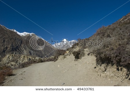
The park consists of churia hills, ox-bow lakes, flood plains of Rapti, Reu and Narayani rivers. The Churia hill rises gradually towards the east from 150 m to over 800 m. The lower but most rugged Someshwor hills occupy most of the western portion of the park. The flood plains of Chitwan are rich alluvial. The park boundaries have been delineated by the Narayani and Rapti rivers in the north and west, and the Reu river and Someshwor hills in the south and south-west. It shares its eastern border with Parsa Wildlife Reserve.
Vegetation and Animals:
• The Chitwan valley is characterized by tropical to subtropical forest. 70% of park vegetation is predominantly Sal ( Shorea robusta ) forest, a moist deciduous climax vegetation type of the Terai region. The remaining vegetation types include grassland (20%), riverine forest (7%) and Sal with Chirpine ( Pinus roxburghii ) (3%), the latter occurring at the top of the Churia range. The riverine forests mainly consists of khair, sissoo and simal. The simal is with spiny bark when young and develops buttress at the bottom in older stage. The grasslands form a diverse and complex community with over 50 species. The Sacchrum species, often called elephant-grass can reach 8 m in height. The shorter grasses such as Imperata is useful for thatch roofs.
• There are more than 43 species of mammals in the park. The park is specially renowned for the protection of the endangered one-horned rhinoceros, tiger, gharial crocodile along with many other common species of wild animals. The estimated population of endangered species of animals such as gaur, wild elephant, four horned antelope, striped hyena, pangolin, gangetic dolphin, monitor lizard and python, etc.
• Some of the other animals found in the park are samber, chital, hog deer, barking deer, sloth bear, common leopard, ratel, palm civet, wild dog, langur, rhesus monkey, etc.
• There are over 450 species of birds in the park. Among the endangered birds found in the park are Bengal florican, giant hornbill, lesser florican, black stork and white stork, Few of the common birds seen are peafowl, red jungle fowl, and different species of egrets, herons, kingfishers, flycatchers and woodpeckers. The best time for bird watching is March and December.
• More than 45 species of amphibians and reptiles occur in the park and some of which are marsh mugger crocodile, cobra, green pit viper and various species of frogs and tortoises.
• The park is actively engaged in the scientific studies of several species of wild flora and fauna.
Seasons:
• The park is under the tropical monsoon climate with relatively high humidity. The winter, spring and monsoon are the three main seasons. The cool winter season occurs from October to February. The spring begins in March and is soon followed by summer that ends in early June. The summer days are typically hot with 30 C on average day temperature. The monsoon usually begins at the end of June and continues until September. The mean annual rainfall is about 2150 mm and during this time of the year rivers are flooded and most of the roads are virtually closed.
How to Get There:
• The park is accessible by car or bus on the Kathmandu-Mugling-Narayanghat Highway and or through Mahendra Rajmarg Highway from Hetauda. It is about 6 hour's drive from Kathmandu to Narayanghat. Local buses are available to Tadi Bazar which is about an hour drive form Narayanghat. A 6 km walk or bullockcart ride brings the visitors to Sauraha, the park entrance. Also air services from Kathmandu to Meghauli for US$82 each way and Bharatpur US$65 each way are available. Local buses are available form Narayanghat to Park HQ. Kasara.
Park Facilities:
• Display Center, Kasara
• Library at Kasara Sauraha
• Visitor Center, Sauraha
• Machans (View tower)
Activities:
• Elephant ride
• Canoeing
• Guided jungle walk
• Terai culture
• Wildlife breeding projects
• 4WD safaris
Enrty fees into Royal Chitwan National Park:
• National Park entry fee per person per day:
• For Nepali Nationals Rs 20
• For SAARC NAtionals Rs 200
• For Foreign Nationals Rs 500
• Children under 10 years Free
• Elephant ride for about 2 hrs. - Rs 550 - (Nepali's Rs 100)
• Fishing permit - Rs 300 - (Nepali's Rs 20)
• Camping per night per person - Rs 300 - (Nepali's Rs 20)
• Guided jungle walk - Rs 250/400 for half day/full day - (Nepali's Rs 20)
• Canoeing - Rs 230 per person
• 4WD safari - Rs 650 per person
• Gharial crocodile breeding centre - included in the park entrance fee
• Elephant breeding centre - included in the park entrance fee
• Lodges offer all-inclusive packages for 2 to 4 days for those who want everything pre- organised by the lodge guides.

Khaptad (Baba) National Park


Khaptad National Park is located in the mid-mountain region of Far-Western Nepal at an air distance of 446 km from Kathmandu. The core area is situated at the cross point of Bajhang, Bajura, Doti and Achham Districts of Seti Zone. The Park HQ. at Khaptad is about 50 km and 32 km walking distance respectively from Silgadhi town (Doti) and Chainpur town (Bajhang).
The park covers a unique ecosystem of the mid-mountain region of Western Nepal and is situated at around 3000 m elevation. The upland is a rolling plateau with grasslands intermixed with oak and coniferous forests.
The summer is cool and wet, whereas, the winter is cold and dry. The monsoon begins in June and ends in September with rainfall averaging less than 1000 mm. Occasional snowfall in winter with chilling wind is another characteristic.
Vegetation and Wildlife:
• There is a great variety of vegetation type ranging from sub-tropical forest in the lower altitudes (Jhingrana and Chaikot of Dopti) to temperate forests on the Khaptad plateau. The most common tree species are chirpine (Pinus roxburghii), spruce (Picea smithiana), fir (Abies spectabilis), maple (Acer pictum), birch (Betula utilis), alder (Alnus nepalensis) and rhododendron (Rhododendron spp.). Dense bamboo stands (nigalo) and wide varieties of medicinal herbs occur in the park.
• The most common fauna in the park are leopard (Panthera pards), Himalayan yellow-throated marten (Martes flavigula), Himalayan black bear (Sus scrofa), jackal (Canis aureus), musk deer (Mochus moschiferus), goral (nemorhaedus goral), Himalayan tahr (Hemitragus jemlahicus), wolf (Canis lupus) and common langur (Presbytis entellus).
• The common bird species include the Impeyan pheasant (danphe), Nepal's national bird (Lophophorus impejanus), chukor partridge (Alectoris graeca), Kalij pheasant (Lophuralleucomelana), Monal (Tragopan satyara), red and yellow-billed blue magpie (Cissa erythrorhyncapa & c. flavirostris), nutcracker (Nucifraga caryooatactes), flycatchers (Muscicapa & Muscicapella spp.), thrushes (Garrulax spp. & Zoothera spp.), Himalayan griffin ( Gyps himalayansis), cuckoos (Cuculus spp.), forktails (Enicurus spp.), tits (Parus spp.), wagtails (motacilla spp.) and eagles (Aquila spp.). A wide variety of colorful butterflies, moths and insects are also important features of the Khaptad ecosystem.
Seasons:
• Climatically the best times to visit the park are during spring (March-May) and autumn (October-November). The temperature during these times range from 10 - 20 C.
Religious Zone:
• A meditation zone has been set aside at the core of the park, containing religious sites and the ashram of Khapatad Swami, a renowned spiritual saint. The important religious sites are Tribeni, Sahashra Linga and the ashram. The religious center is considered as a place for meditation and tranquillity. Therefore, smoking, chewing tobacco and consumption of alcohol is prohibited. Similarly slaughtering of animal or killing any animals or birds are also prohibited.
How to Get There:
• Plane flight to Bajhang (Chainpur) from either Kathmandu, Nepalgunj, or Dhangadhi followed by a two-day walk.
• Plane flight to Doti (Dipaya) from places mentioned above, and a three-day walk.
• Plane flight to Bajura (Kolti) from above mentioned places and a four-day walk.
• Plane flight to Accham (Sanphebagar) from above places and a two-day walk.
• There is a fair weather motorable road from Dhangadhi to Dipayal via Bhasu Lekh. From Dipayal is a three-day walk to reach the park HQ. at Khaptad.
Important Points:
• No one should walk within the park after sunset or before sunrise.
• No one should stay overnight or use alcoholic beverages, eat meat, smoke or violate the peace of the meditation area in any way.
• Flora fauna of the park are fully protected and must not be disturbed.
• Visitors should be self-sufficient in every way, especially in fuel, before entering the park.
• Rubbish should be buried or disposed of in designate places.
• Trekking in Khaptad National Park is very interesting. Porters are usually available at the trek starting points with some exceptions. Trekkers should be self-sufficient with tents, fuel and food as there are no commercial lodges available inside the park.
Entry fees into Khaptad National Park:
An entry fee as per park rules should be paid at the entrance gates.
• National Park fees per person per entry:
• For Nepali Nationals Free
• For SAARC Nationals Rs 100
• For Foreign Nationals Rs 1000
• Children under 10 years Free

Makalu-Barun National Park and Conservation Area


High in the heart of the eastern Himalayan, seven valleys radiate from Mt. Makalu, the world's fifth highest peak. These valleys, particularly the Barun valley, treasure some of the last remaining pristine forest and alpine meadows of Nepal. From the bottom of the Arun valley, at just 435 m above sea level, the Himalayas rise to the snow-capped tip of Makalu 8463 m within a 40 km distance. Within this wide range of altitudes and climates, the Makalu-Barun area contains some of the richest and most diverse pockets of plants and animals in Nepal, elsewhere lost to spreading human habitation.
Nestled in the lower reaches of these valleys are communities of Rai, Sherpa, and Shingsawa (Bhotia) farmers. Though economically poor and isolated, they retain a rich cultural heritage. They hold the key to the preservation of the unique biological and cultural treasures of the Makalu-Barun area.
The Makalu-Barun National Park and Conservation Area was established in 1992 as Nepal's eighth national park and the first to include and adjacent inhabited conservation area as a buffer. A new park management approach encourages local people to become actively involved in protecting the forests and natural resources upon which their lives depend, and in conserving their own rich cultural heritage. Traditional resource management systems, such as community controlled grazing and forest guardianship, are being strengthened and low level technologies introduced where appropriate. Working in collaboration with an American NGO, Woodlands Mountain Institute, His Majesty's Government, Nepal is striving to improve local living standards through infrastructure, educational and income-generating activities.
Covering 2330 sq. km Makalu-Barun is a vital component of the greater Mount Everest ecosystem which includes Nepal's 1,148 sq. km Sagarmatha (Mount Everest) National Park to the west and the 35000 sq. km Comolangma Nature Preserve in the Tibet Autonomous Region of China to the north.
Details About the Park:
• Most of the Makalu-Barun National Park is a remote wildness, with just two small settlements and seasonal herding in high pastures. Historically, few foreigners have visited the area except for the occasional climbing expedition.
• The incredibly steep topography and abundant monsoon rains (1000 to 4000 mm per year) of the eastern Himalayan support unusually diverse bioclimatic zones and a rich storehouse of medicinal and useful plants. Alpine pastures above 4000 m contain the religiously important dwarf rhododendron and juniper, aromatic herbs and delicate wildflowers, including 47 different varieties of orchids. Subalpine forests of fir, birch and rhododendron, and temperate stands of oak, maple and magnolia thrive between 2-4000 m. Luxuriant orchids drape the chestnut and pine forests of the subtropical zone (1-2000 m) and sal forests reach their northernmost limit within Nepal along the banks of the Arun (below 1000 m).
• The park has 400 species of birds, including the spotted wren babbler and the olive ground warbler. These two species have never been seen in Nepal before.
• There are many wild animals including the endangered red panda, Himalayan black bear and the clouded leopard. Other wildlife found in the park are: ghoral, tahr, wild boar, barking deer, Himalayan marmot and weasel, common langur monkey and the serow.
• The Arun River gushing through the park has around 84 varieties of fish including salmon.
Strict Nature Reserve:
• The inaccessible lower Barun valley, a glacier-fed tributary to the Arun river, and its tributary the Saldima, flow through the most pristine area in the Park and thus have been designated as a Strict Nature Reserve, the first in Nepal. Here natural ecosystems and processes will be protected in an undisturbed state for scientific study, environmental monitoring, education, and the maintenance of genetic resources.
The Conservation Area:
• Some 32,000 people of ethnically divers backgrounds live in the Conservation Area. The majority belong to various tribes of Rais and practice an ancient religion which reinforces harmony with nature. Shingsawas and Sherpas. Bhotia people originally from Tibet, live at higher elevations and carry on Buddhist traditions. A handful of other hill tribes including Gurung, Tamang, Magar, Newar, Brahmins, Chhetris and occupational castes live in the lower elevations.
• These people live in isolated villages much as they have for centuries. As farmers, herders and seasonal traders, their livelihoods depend heavily upon forest resources for animal fodder, fuel, food, housing materials, fertilizers, medicine and other creative uses, clothing spun from allo (nettles), paper made form lokta (daphne bark) and countless items made from bamboo including furniture, containers, baskets, musical instruments, raincoats, and aqueducts.
How to Get There:
• Fly from Kathmandu to either Lukla, Phaplu, Lamidanda, Bhojpur and Tumlingtar airstrips, and then trek to reach the park.
Entry fees into Makalu Barun National Park and Conservation Area:
• National Park entry fees per person per entry:
• For Nepali Nationals Free
• For SAARC Nationals Rs 100
• For Foreign Nationals Rs 1000
• Children under 10 years Free

Royal Suklaphant Wildlife Reserve


The Royal Suklaphanta Wildlife Reserve is situated in the southern part of Far-West Nepal in Kanchanpur District. The reserve lies between 80o 25' east longitude and 28o 35' north latitude.
The reserve had been a famous hunting area for many years and was declared a Royal Hunting Reserve in 1969. The reserve was gazetted in 1973 as Royal Suklaphanta Wildlife Reserve. It began as an area of 155 sq. km, today the reserve covers an area of 305 sq. m after completion of an extension.
The riverine flood plain of the reserve comprises of hill wash and alluvial deposits. Sal (Shorea robusta) is the dominant tree species. Extensive grasslands (locally called phanta) provide an ideal habitat for swamp deer (Cervus duvauceli). The species is endangered and there is a population of about 2000 in the reserve.
Seasons:
• The reserve has typically four seasons, winter, spring, summer and monsoon. The months of December and January are fairly cold and misty with occasional frost. Temperatures during the winter range from 10 to 12 C, gradually rising up to 22 to 25 C in February and March. In the pre-monsoon period (April-June) the temperatures range form 30 to 32 C and sometimes reaching as high as 42 C with increasing humidity.
Vegetation and Wild Animals:
• Predominant sal (Shorea robusta) forest is associated with asna (Terminalia alata), semal (Bombaxceiba), and karma (Adina Cordifolia). Khair, (Acacia catechu) and sissoo (Dolbergia sisso) forest is found along the river side. The main grass species of the phantas are Imperata cylindrica and Saccharum heteropogon which are extensively used by the local people for thatching.
• The reserve provides prime habitat for swamp deer (Cervus duvauceli). An estimated population of 2000 is found in the reserve. Other wild animals in the reserve are wild elephant (Elephas maximus), tiger (Panthera tigris), hispid hare (Caprolagus hispidus), blue bull (Boselaphus tragocamelus), leopard (Panthera pardus), chital (Zxis axis), hog deer (Zxis porcinus) and wild boar (Sus scrofa).
• A total 268 species of birds has been recorded in the reserve. Many grassland birds along with the rare Bengal florican can be seen in the phantas. Marsh mugger crocodile, Indian python, monitor lizard and snakes like cobra, krait and rat snake have been recorded in the reserve.
Tourist Attraction:
• The extensive open grasslands of Suklaphanta are worth visiting for a breathtaking view of the largest herd of swamp deer in the world and other grassland birds including Bengal florican.
• Wetlands such as Ranital, Sikarital and others in the extension area like Kalikitch Lake, Lalpanital and Taratal, support a healthy population of many kinds of waterfowl, reptiles and other wildlife.
• Ranital, 18 km. from the reserve HQ., is a beautiful lake for viewing waterfowl, with machans (viewing towers).
How to Get There:
• The reserve is accessible by road as well as by air. The reserve will be easily accessible by road from any parts of Nepal with the completion of the far-western sector of East-West Highway. There is once a week flight from Kathmandu to Dhangadhi which is 51 km. far from the park headquarters. There is regular public bus service from Dhangadhi to Mahendranagar taking 3 hours drive and the reserve headquarters is 8 km south-west of Mahendranagar. The reserve can be reached by East-West Highway through Nepalgunj-Dhangadhi-Mahendranagar.
Important Points:
• Movement inside the reserve is restricted between sunrise and sunset.
• Flora and fauna are totally protected and must not be disturbed.
• Rubbish must be either carried away or disposed in a designated place.
• Do carry a comprehensive first aid kit with you, including medicines for intestinal problems.
• A small information center is maintained at the reserve HQ at Majhgaon.
Entry Fees into Royal Shuklaphanta Wildlife Reserve:
• Entry fees per person per day:
• For Nepali Nationals Rs 20
• For SAARC Nationals Rs 200
• For Foreign Nationals Rs 500
• Children under 10 years free.
• Camping in comfortable tents - US$175 per person, including all meals, wildlife drives and walks. Visit to local Tharu villages can also be arranged.
• For vehicle Fee - Rs 2000
• Elephant ride per hour per person - Rs 1000

The Annapurna Conservation Area


The area has been a smash hit in the world of conservation. Perhaps this is the area that pioneered a successful conservation without armed personnel. With the help of the local people, this highland could be well protected. With a trekking circuit from mid hills to the foothills of the Himalayas - Annapurna region covers an area of 7629 sq. km. Beginning from 790 m, the highest altitude reaches 8091 m of the Mountain Annapurna 1. This is the most visited trekking area in the mountain region. More than 60000 visitors every year.
Annapurna Conservation Area Project (ACAP) has been running it's programs in the area with an aim to conserve nature and it's local community. (For more information visit our ACAP page)
Vegetation and Wild Animals:
• The Annapurna Conservation Area offers innumerable sights of water falls, mountains, natural flowers and rural settlements. If you trek from the west you will be travelling along the Kali Gandaki River.
• Apart from natural sights, the area is rich with flora and fauna. There are above 1200 plants with around 40 orchids and 9 species of rhododendron - the national flower. There are around 100 mammals including the rare snow leopard and blue sheep in the upper sub-alpine area, 478 species of birds such as the protected multi-coloured Impheyan, koklas and blood pheasants. 39 reptiles and 22 amphibians and many types of butterflies in the area.
Tourist Attraction:
• Reaching beyond the Himalayas, both on foot or by flight, this is one of the most fascinating expereince while trekking in the Annapurna Circuit.
• Trekkers beginning their adventure either from the west or east starting point, reach behind Mt. Nilgiri as they near Jomsom, the District Headquarters of Mustang.
• While you celebrate your victory for having reached behind the Himalayas you can see the above 8000 m mountains like Dhaulagiri standing right infront of you.
• Ghandruk will be your first expereince where you will see the locals have conserved ecology and at the same time have earned their livelihood through tourism.
• Past Ghandruk you will reach Ghorepani from where you can sight a panoramic view of the Annapurna ranges to the north on top of Poon Hill.
• Descending from Ghorepani, as you go towards the north, you reach Tatopani where there are natural hot water springs, that offer an excellent place to relax and bathe.
• As you proceed further towards Jomsom you reach a place called Kalapani. From here is where Mt. Dhaulagiri stands on the same ground you are standing on!
• Jomsom is a popular place for visitors where you experience many cultural sights. Annapurna region has around 120000 human population from 10 different ethnic cast groups.
• For more nature and cultural sightseeing go towards the north at Kagbeni, where you can continue onto explore the Upper Mustang - the once forbidden Kingdom. Or trek towards the Muktinath Temple, the Hindu pilgrimage at the height of almost 4000 m. Further ahead is the Thorung La Pass at an altitude of 5410 m. If you want to climb over the pass it is better to do it from the east side, going around the circuit anti-clockwise, makes climbing the pass alot easier
How to Get There:
• The Area is easily accessed from Pokhara. A three hour bus drive to Beni in the west and start trekking into the area, or a one hour bus drive to Besi Sahar in the east to start the Annapurna Circuit trek. A one hour bus drive to Naya Pul (Birethanti) to start the trek to Annapurna Base Camp or Jomsom, or fly to Jomsom from Pokhara and trek back down.
Important Points:
• There are many small lodges/teahouses along the way which will provide food, drinks and accomodation.
• Government regulations prohibits lighting camfires in the conservation area. You need to carry kerosene and sufficient warm clothing.
• Visitors should carry out what they carry in. Place rubbish designated palces.
• The flora and fauna in the area are fully protected. They should not be disturbed.
• Do not wear revealing clothing.
• Respect privacy. Ask before photographing people or religious sites.
Entry fees into the Annapurna Conservation Area:
• Conservation Area fees per person per entry.
• For Nepali Nationals Free
• For SAARC Nationals Rs 200
• For Foreign Nationals Rs 2000
• Children under 10 years Free

Manasalu Conservation Area

This is yet another conservation area in the mountain region. Bordering the Annapurna Conservation Area to the west and Tibetan Plateau on the north and the east, the Manasalu region lies in Gorkha District to the west of Kathmandu.
Basically a trekking area, the regions altitude rises from a mere 600 m to 8163 m, the summit of Mt. Manasalu - the eighth highest peak in the world.
To make conservation a success story the government has joined hands with the King Mahendra Trust for Nature Conservation (KMTNC) and the Asian Development Bank. The Manasalu Eco-Tourism Development Project has been on in the region since 1997.
The projects main objective is to deliver tangible benefits from tourism to the local community while minimizing adverse environmental impacts through the development of eco-tourism.
The project has proposed seven Village Development Committees, totaling an area of 1663 sq. km in the Manasalu region, to be turned into a conservation area within five years.

Tourist Attraction:
• The area offers a classic setting for trekkers. Visitors here will have the opportunity to experience both nature and culture that would have otherwise disappeared had there been no conservation efforts.
• The region is full of pristine nature beckoning trekkers to explore more of it. The trekking route in the region follows the Budi Gandaki River before reaching the Larke Pass (5106 m) and crossing over into the Manang District of the Annapurna Conservation Area.
• As trekkers trudge through the rugged terrain, they can see the towering snow covered mountains to the north.
• The region harbors a mosaic of habitats for 29 species of mammals, including the rare snow leopard, musk deer and the Himalayan Tahr.
• There are over 20 species of birds and three species of reptiles. What provides cover to these fauna is over 200 species of plants, 11 types of forests, and over 50 species of useful plants.
• More than 7000 people live in the seven V.D.C's in the area. The major ethnic group, the Gurungs, has been a strong attachment towards its traditional Tibetan Culture Heritage.
• Monasteries and chhortens dot the trekking route. These are the places where festivals and traditional dances take place.
After visiting the area, if visitors wish to extend their trek they can easily do so by reaching the Annapurna region in the neighborhood.
How to Get There:
• Trekking to the Manasalu region generally starts from Arughat, between Gorkha and Dhading.
• Arughat can be reached by bus from Kathmandu. This is also where an information center of the Manasalu Eco-Tourism Project is located. The head office of the project is located ion the Park V.D.C of the Manasalu Conservation Area.
• Another starting point to the area is Daraundi in Gorkha from where you will have to hike to Sirdiwas reaching the normal trekking trail.
Important Points:
• Like in any protected areas, the flora and fauna in the conservation area is fully protected.
• Visitors should be equipped with camping gear and fuel supply.
• Carry rubbish away with you or put in designated area.
Entry fee into Manasalu Conservation Area:
• Conservation Area entry fee per person per entry
• For Nepali Nationals Free
• For SAARC Nationals Rs 200
• For Foreign Nationals Rs 2000
• Children under 10 years Free

Kanchanjunga Conservation Area

Just below the looming Mountain Kanchanjunga (8586 m), lies the Kanchanjunga Conservation Area. Spread in an area of 2035 sq. km, the area is made up of alpine grass lands, rocky outcrops, dense temperate and sub-tropical forests, and low river valleys with the Kanchanjunga as its crown.
Situated in north eastern Nepal in Taplejung District, the conservation area is bordered by the Tibet Autonomous Region-China in the north, Sikkim-India in the east and Sankhuwasabha District in the west.
In 1998, the Department of National Parks and Wildlife Conservation and WWF Program together launched the Kanchanjunga Conservation Area Project to implement biodiversity conservation and sustainable development.
Details about the Conservation Area:
•The Kanchanjunga Conservation Area can be synonymized as a repository of flora and fauna.
•During the spring season, the area has an excellent display of flowering rhododendrons, orchids, lilies, primula and many other flowers.
•The lowlands are full of tropical hardwoods. These get replaced by oaks and pine as the elevation increases. Further higher is the vegetation including larch, fir and juniper up to the tree line.
•The conservation area is where you will see 15 of Nepal's 28 endemic flowering plants. Almost all the 30 kinds of rhododendron species are found here. This is also the area where you get to see 69 of the 250 orchids found in Nepal.
•Kanchanjunga Conservation Area harbors rich diversity of wildlife including the endangered snow leopard, Himalayan black bear, musk deer, and red panda. Other animals in the area include the blue sheep, and many others.
•Impheyan pheasant, red-billed blue magpie, shy drongo are some of the many birds found in the area.
•The conservation area has a lot of ethnic diversity and culture. As the original settlers of the Upper Tamur Valley, the Limbu are the dominant ethnic group in the lower regions. The Sherpa/Lama people are in the higher altitude where they arrived from Tibet more than four hundred years ago.
•These Sherpas have a distinct culture and tradition from those in the Solukhumbu District in the Sagarmatha Region. Also Rais, chhetris, Brahmins and others live in Kanchanjunga.
•Monasteries, chhortens, temples, prayer-walls are the icons of the conservation area's cultural heritage.
Tourist Attraction:
•For an excellent view of the Mountain Kanchanjunga, you should reach the North base camp where a place called Bangpema is the excellent point for observation of the mountain.
• To make a circular trek you will have to pass through the Celele Pass at an altitude of about 4000 m to drop to Tseram from where you head toward the South base camp, another excellent observation point of Mt. Kanchanjunga. On the way back, you will have to pas through Yamphudiun village to reach Sukheter from where you can fly to Biretnagar.
How to Get There:
•You can reach the conservation area by bus through Dharan. From here you will have to walk to Kunsa inside the conservation area.
•Royal Nepal Airlines has its morning flights everyday between Birantnagar and Sukhetar. And there are everyday flights between Kathmandu and Birantnagar. Some private airlines operate from Kathmandu to Sukhetar.
•Another way to get to Kanchangunga Conservation Area is Birtamod in eastern Jhapa District. From Birtamod and travel by local bus to Taplejung Bazaar, this road is seasonable though.
Important Points:
•To get a permit to this conservation area you need to be pert of an organized trekking group.
•Visitors should be equipped with camping gear and fuel supply.
•Carry out non-biodegradable items and dispose in a designated area.
•Flora and fauna in the park is fully protected, do not disturb them.
•Do not buy anything made from wildlife products.
Entry fees into Kanchanjunga Conservation Area:
•Conservation Area entry fee per person per entry:
•For Nepali Nationals Free
•For SAARC Nationals Rs 200
•For Foreign Nationals Rs 2000
•Children under 10 years Free

Saturday, February 18, 2012

History of Baglung

History of Baglung can be traced back to early 16th century. King Pratapi Nayayan of Galkot married the princess of Palpa. The king brought goddess kali along with him as dowry. Legend follows; nobody was able to carry the sword of Kali. A youth from Kunwar chhetri family was finally able to carry the sword. He was given the honorary title of Khadka (‘khadga’ meaning the sword). One night when the wedding procession reached where Baglung is today, the king had a dream. In his dream goddess Kali said she liked the place and wished to stay there. The king then built a temple in honor of goddess Kali and designated the Khadka as caretaker. This was in 1590 B.S. (1533 A.D.). Significant population of Khadka Chhetris can be found in Baglung till date. The strategic location of Baglung soon helped it to grow into a trading town. King Pratapi Narayan also started the tradition of holding an annual fair during ‘Chaitre Dashain’. The fair is still held annually and draws thousands of visitors every year during the two day event. Baglung remained to stay a major trading point in Parvat kingdom, where merchants from south came to trade for salt brought by Traders from Tibet. Major trade was carried along the Kali Gandaki valley between India and Tibet by Thakali people. Newar merchants migrated to Baglung from Bhaktapur in 18th century. Baglung became part of Greater Nepal (Bishal Nepal) under unification war led by King Prithvi Narayan Shah. Under unified Nepal, several government offices were established and the town was designated as administrative headquarters of the region. Since then it has remained the most important political and economic town in the Dhaulagiri Zone

Baglung

Baglung is the most popular place of nepal.It has 59 Village Development Committees and one Municipality. It has many rivers and streams and so, many suspension bridges. Baglung is also known as the district of suspension bridges because of the large number of bridges. It is a hilly district, most of the population settled in the sides of the rivers. Fertile planes situated in the either sides of the rivers are used for farming. Headquarter of Baglung (Baglung Bazaar) is also situated in the bank of the holy river- Kaligandaki. Like Nepal, Baglung is also diverse in religion, culture, ethnicity, altitude, temperature etc. Hinduism and Buddhism are the major religions. Magar, Chhetri, Bramhan, Newar, Gurung, Chhantyal and Thakali are the main ethnic groups living in Baglung. Highest temperature in the lowest altutude of baglung rises up to about 37.5 degrees Celsius in summer and the lowest temperature at Dhorpatan falls up to about −15 degrees Celsius in winter. Altitude of Baglung varies from about 650 meters at Kharbang to about 4,300 meters in Dhorpatan.
Baglung is rich in herbal Baglung is surrounded by Parvat, Myagdi, Rukum, Ropla, Pyuthan and Gulmi districts. It looks like Nepal medicine plants. Rice, corn, millet, wheat and potato are the major crops of baglung.There were many mines in use in Baglung in the past; Iron and Copper mines being the most prevalent. But they are not in use for long time because of the heedlessness of the government. There are numerous slate mines in use in Baglung. These slates are excellent for roofing.
Baglung Bazaar, Hatiya- Galkot, Kushmi Sera and Burtibang are the main trading centers of Baglung. Galkot, Kushmi Sera and Burtibang are connected with the district headquarter Baglung Bazaar by raw roads. Small part of Baglung is electrified by Nepal Electricity Authority and some other parts are electrified by small local hydroplants. Recently, telephone has been accessible in almost all villages of Baglung.
Baglung is considered to be one of the politically most conscious districts and it plays a significant role in the Nepali politics.