Himalayan Range of Nepal

This is a photograph of Himalayan Range of Nepal.

Hatiya Bazaar from Ghumte Hill

Hatiya Bazaar from Ghumte.

Hatiya Bazaar From Charaudi

Hatiya Bazaar From Charaudi

Suspension Bridge of Hatiya

Suspension Bridge of Hatiya

Beautiful picture of Himalayan village

Beautiful picture of Himalayan village

Showing posts with label Nepal Conservation Area. Show all posts

Sunday, February 19, 2012

Makalu-Barun National Park and Conservation Area


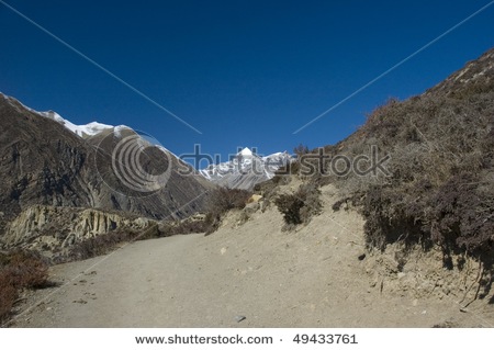
High in the heart of the eastern Himalayan, seven valleys radiate from Mt. Makalu, the world's fifth highest peak. These valleys, particularly the Barun valley, treasure some of the last remaining pristine forest and alpine meadows of Nepal. From the bottom of the Arun valley, at just 435 m above sea level, the Himalayas rise to the snow-capped tip of Makalu 8463 m within a 40 km distance. Within this wide range of altitudes and climates, the Makalu-Barun area contains some of the richest and most diverse pockets of plants and animals in Nepal, elsewhere lost to spreading human habitation.
Nestled in the lower reaches of these valleys are communities of Rai, Sherpa, and Shingsawa (Bhotia) farmers. Though economically poor and isolated, they retain a rich cultural heritage. They hold the key to the preservation of the unique biological and cultural treasures of the Makalu-Barun area.
The Makalu-Barun National Park and Conservation Area was established in 1992 as Nepal's eighth national park and the first to include and adjacent inhabited conservation area as a buffer. A new park management approach encourages local people to become actively involved in protecting the forests and natural resources upon which their lives depend, and in conserving their own rich cultural heritage. Traditional resource management systems, such as community controlled grazing and forest guardianship, are being strengthened and low level technologies introduced where appropriate. Working in collaboration with an American NGO, Woodlands Mountain Institute, His Majesty's Government, Nepal is striving to improve local living standards through infrastructure, educational and income-generating activities.
Covering 2330 sq. km Makalu-Barun is a vital component of the greater Mount Everest ecosystem which includes Nepal's 1,148 sq. km Sagarmatha (Mount Everest) National Park to the west and the 35000 sq. km Comolangma Nature Preserve in the Tibet Autonomous Region of China to the north.
Details About the Park:
• Most of the Makalu-Barun National Park is a remote wildness, with just two small settlements and seasonal herding in high pastures. Historically, few foreigners have visited the area except for the occasional climbing expedition.
• The incredibly steep topography and abundant monsoon rains (1000 to 4000 mm per year) of the eastern Himalayan support unusually diverse bioclimatic zones and a rich storehouse of medicinal and useful plants. Alpine pastures above 4000 m contain the religiously important dwarf rhododendron and juniper, aromatic herbs and delicate wildflowers, including 47 different varieties of orchids. Subalpine forests of fir, birch and rhododendron, and temperate stands of oak, maple and magnolia thrive between 2-4000 m. Luxuriant orchids drape the chestnut and pine forests of the subtropical zone (1-2000 m) and sal forests reach their northernmost limit within Nepal along the banks of the Arun (below 1000 m).
• The park has 400 species of birds, including the spotted wren babbler and the olive ground warbler. These two species have never been seen in Nepal before.
• There are many wild animals including the endangered red panda, Himalayan black bear and the clouded leopard. Other wildlife found in the park are: ghoral, tahr, wild boar, barking deer, Himalayan marmot and weasel, common langur monkey and the serow.
• The Arun River gushing through the park has around 84 varieties of fish including salmon.
Strict Nature Reserve:
• The inaccessible lower Barun valley, a glacier-fed tributary to the Arun river, and its tributary the Saldima, flow through the most pristine area in the Park and thus have been designated as a Strict Nature Reserve, the first in Nepal. Here natural ecosystems and processes will be protected in an undisturbed state for scientific study, environmental monitoring, education, and the maintenance of genetic resources.
The Conservation Area:
• Some 32,000 people of ethnically divers backgrounds live in the Conservation Area. The majority belong to various tribes of Rais and practice an ancient religion which reinforces harmony with nature. Shingsawas and Sherpas. Bhotia people originally from Tibet, live at higher elevations and carry on Buddhist traditions. A handful of other hill tribes including Gurung, Tamang, Magar, Newar, Brahmins, Chhetris and occupational castes live in the lower elevations.
• These people live in isolated villages much as they have for centuries. As farmers, herders and seasonal traders, their livelihoods depend heavily upon forest resources for animal fodder, fuel, food, housing materials, fertilizers, medicine and other creative uses, clothing spun from allo (nettles), paper made form lokta (daphne bark) and countless items made from bamboo including furniture, containers, baskets, musical instruments, raincoats, and aqueducts.
How to Get There:
• Fly from Kathmandu to either Lukla, Phaplu, Lamidanda, Bhojpur and Tumlingtar airstrips, and then trek to reach the park.
Entry fees into Makalu Barun National Park and Conservation Area:
• National Park entry fees per person per entry:
• For Nepali Nationals Free
• For SAARC Nationals Rs 100
• For Foreign Nationals Rs 1000
• Children under 10 years Free

The Annapurna Conservation Area


The area has been a smash hit in the world of conservation. Perhaps this is the area that pioneered a successful conservation without armed personnel. With the help of the local people, this highland could be well protected. With a trekking circuit from mid hills to the foothills of the Himalayas - Annapurna region covers an area of 7629 sq. km. Beginning from 790 m, the highest altitude reaches 8091 m of the Mountain Annapurna 1. This is the most visited trekking area in the mountain region. More than 60000 visitors every year.
Annapurna Conservation Area Project (ACAP) has been running it's programs in the area with an aim to conserve nature and it's local community. (For more information visit our ACAP page)
Vegetation and Wild Animals:
• The Annapurna Conservation Area offers innumerable sights of water falls, mountains, natural flowers and rural settlements. If you trek from the west you will be travelling along the Kali Gandaki River.
• Apart from natural sights, the area is rich with flora and fauna. There are above 1200 plants with around 40 orchids and 9 species of rhododendron - the national flower. There are around 100 mammals including the rare snow leopard and blue sheep in the upper sub-alpine area, 478 species of birds such as the protected multi-coloured Impheyan, koklas and blood pheasants. 39 reptiles and 22 amphibians and many types of butterflies in the area.
Tourist Attraction:
• Reaching beyond the Himalayas, both on foot or by flight, this is one of the most fascinating expereince while trekking in the Annapurna Circuit.
• Trekkers beginning their adventure either from the west or east starting point, reach behind Mt. Nilgiri as they near Jomsom, the District Headquarters of Mustang.
• While you celebrate your victory for having reached behind the Himalayas you can see the above 8000 m mountains like Dhaulagiri standing right infront of you.
• Ghandruk will be your first expereince where you will see the locals have conserved ecology and at the same time have earned their livelihood through tourism.
• Past Ghandruk you will reach Ghorepani from where you can sight a panoramic view of the Annapurna ranges to the north on top of Poon Hill.
• Descending from Ghorepani, as you go towards the north, you reach Tatopani where there are natural hot water springs, that offer an excellent place to relax and bathe.
• As you proceed further towards Jomsom you reach a place called Kalapani. From here is where Mt. Dhaulagiri stands on the same ground you are standing on!
• Jomsom is a popular place for visitors where you experience many cultural sights. Annapurna region has around 120000 human population from 10 different ethnic cast groups.
• For more nature and cultural sightseeing go towards the north at Kagbeni, where you can continue onto explore the Upper Mustang - the once forbidden Kingdom. Or trek towards the Muktinath Temple, the Hindu pilgrimage at the height of almost 4000 m. Further ahead is the Thorung La Pass at an altitude of 5410 m. If you want to climb over the pass it is better to do it from the east side, going around the circuit anti-clockwise, makes climbing the pass alot easier
How to Get There:
• The Area is easily accessed from Pokhara. A three hour bus drive to Beni in the west and start trekking into the area, or a one hour bus drive to Besi Sahar in the east to start the Annapurna Circuit trek. A one hour bus drive to Naya Pul (Birethanti) to start the trek to Annapurna Base Camp or Jomsom, or fly to Jomsom from Pokhara and trek back down.
Important Points:
• There are many small lodges/teahouses along the way which will provide food, drinks and accomodation.
• Government regulations prohibits lighting camfires in the conservation area. You need to carry kerosene and sufficient warm clothing.
• Visitors should carry out what they carry in. Place rubbish designated palces.
• The flora and fauna in the area are fully protected. They should not be disturbed.
• Do not wear revealing clothing.
• Respect privacy. Ask before photographing people or religious sites.
Entry fees into the Annapurna Conservation Area:
• Conservation Area fees per person per entry.
• For Nepali Nationals Free
• For SAARC Nationals Rs 200
• For Foreign Nationals Rs 2000
• Children under 10 years Free

Manasalu Conservation Area

This is yet another conservation area in the mountain region. Bordering the Annapurna Conservation Area to the west and Tibetan Plateau on the north and the east, the Manasalu region lies in Gorkha District to the west of Kathmandu.
Basically a trekking area, the regions altitude rises from a mere 600 m to 8163 m, the summit of Mt. Manasalu - the eighth highest peak in the world.
To make conservation a success story the government has joined hands with the King Mahendra Trust for Nature Conservation (KMTNC) and the Asian Development Bank. The Manasalu Eco-Tourism Development Project has been on in the region since 1997.
The projects main objective is to deliver tangible benefits from tourism to the local community while minimizing adverse environmental impacts through the development of eco-tourism.
The project has proposed seven Village Development Committees, totaling an area of 1663 sq. km in the Manasalu region, to be turned into a conservation area within five years.

Tourist Attraction:
• The area offers a classic setting for trekkers. Visitors here will have the opportunity to experience both nature and culture that would have otherwise disappeared had there been no conservation efforts.
• The region is full of pristine nature beckoning trekkers to explore more of it. The trekking route in the region follows the Budi Gandaki River before reaching the Larke Pass (5106 m) and crossing over into the Manang District of the Annapurna Conservation Area.
• As trekkers trudge through the rugged terrain, they can see the towering snow covered mountains to the north.
• The region harbors a mosaic of habitats for 29 species of mammals, including the rare snow leopard, musk deer and the Himalayan Tahr.
• There are over 20 species of birds and three species of reptiles. What provides cover to these fauna is over 200 species of plants, 11 types of forests, and over 50 species of useful plants.
• More than 7000 people live in the seven V.D.C's in the area. The major ethnic group, the Gurungs, has been a strong attachment towards its traditional Tibetan Culture Heritage.
• Monasteries and chhortens dot the trekking route. These are the places where festivals and traditional dances take place.
After visiting the area, if visitors wish to extend their trek they can easily do so by reaching the Annapurna region in the neighborhood.
How to Get There:
• Trekking to the Manasalu region generally starts from Arughat, between Gorkha and Dhading.
• Arughat can be reached by bus from Kathmandu. This is also where an information center of the Manasalu Eco-Tourism Project is located. The head office of the project is located ion the Park V.D.C of the Manasalu Conservation Area.
• Another starting point to the area is Daraundi in Gorkha from where you will have to hike to Sirdiwas reaching the normal trekking trail.
Important Points:
• Like in any protected areas, the flora and fauna in the conservation area is fully protected.
• Visitors should be equipped with camping gear and fuel supply.
• Carry rubbish away with you or put in designated area.
Entry fee into Manasalu Conservation Area:
• Conservation Area entry fee per person per entry
• For Nepali Nationals Free
• For SAARC Nationals Rs 200
• For Foreign Nationals Rs 2000
• Children under 10 years Free

Kanchanjunga Conservation Area

Just below the looming Mountain Kanchanjunga (8586 m), lies the Kanchanjunga Conservation Area. Spread in an area of 2035 sq. km, the area is made up of alpine grass lands, rocky outcrops, dense temperate and sub-tropical forests, and low river valleys with the Kanchanjunga as its crown.
Situated in north eastern Nepal in Taplejung District, the conservation area is bordered by the Tibet Autonomous Region-China in the north, Sikkim-India in the east and Sankhuwasabha District in the west.
In 1998, the Department of National Parks and Wildlife Conservation and WWF Program together launched the Kanchanjunga Conservation Area Project to implement biodiversity conservation and sustainable development.
Details about the Conservation Area:
•The Kanchanjunga Conservation Area can be synonymized as a repository of flora and fauna.
•During the spring season, the area has an excellent display of flowering rhododendrons, orchids, lilies, primula and many other flowers.
•The lowlands are full of tropical hardwoods. These get replaced by oaks and pine as the elevation increases. Further higher is the vegetation including larch, fir and juniper up to the tree line.
•The conservation area is where you will see 15 of Nepal's 28 endemic flowering plants. Almost all the 30 kinds of rhododendron species are found here. This is also the area where you get to see 69 of the 250 orchids found in Nepal.
•Kanchanjunga Conservation Area harbors rich diversity of wildlife including the endangered snow leopard, Himalayan black bear, musk deer, and red panda. Other animals in the area include the blue sheep, and many others.
•Impheyan pheasant, red-billed blue magpie, shy drongo are some of the many birds found in the area.
•The conservation area has a lot of ethnic diversity and culture. As the original settlers of the Upper Tamur Valley, the Limbu are the dominant ethnic group in the lower regions. The Sherpa/Lama people are in the higher altitude where they arrived from Tibet more than four hundred years ago.
•These Sherpas have a distinct culture and tradition from those in the Solukhumbu District in the Sagarmatha Region. Also Rais, chhetris, Brahmins and others live in Kanchanjunga.
•Monasteries, chhortens, temples, prayer-walls are the icons of the conservation area's cultural heritage.
Tourist Attraction:
•For an excellent view of the Mountain Kanchanjunga, you should reach the North base camp where a place called Bangpema is the excellent point for observation of the mountain.
• To make a circular trek you will have to pass through the Celele Pass at an altitude of about 4000 m to drop to Tseram from where you head toward the South base camp, another excellent observation point of Mt. Kanchanjunga. On the way back, you will have to pas through Yamphudiun village to reach Sukheter from where you can fly to Biretnagar.
How to Get There:
•You can reach the conservation area by bus through Dharan. From here you will have to walk to Kunsa inside the conservation area.
•Royal Nepal Airlines has its morning flights everyday between Birantnagar and Sukhetar. And there are everyday flights between Kathmandu and Birantnagar. Some private airlines operate from Kathmandu to Sukhetar.
•Another way to get to Kanchangunga Conservation Area is Birtamod in eastern Jhapa District. From Birtamod and travel by local bus to Taplejung Bazaar, this road is seasonable though.
Important Points:
•To get a permit to this conservation area you need to be pert of an organized trekking group.
•Visitors should be equipped with camping gear and fuel supply.
•Carry out non-biodegradable items and dispose in a designated area.
•Flora and fauna in the park is fully protected, do not disturb them.
•Do not buy anything made from wildlife products.
Entry fees into Kanchanjunga Conservation Area:
•Conservation Area entry fee per person per entry:
•For Nepali Nationals Free
•For SAARC Nationals Rs 200
•For Foreign Nationals Rs 2000
•Children under 10 years Free